|
This is the first edition of Flight Log, a recurring newsletter for all Voyager users. Our goal is to share the latest Voyager news, tips and tricks, and interesting tidbits from the world of aviation. We’re very interested in your feedback! Please send any comments or suggestions to sales@SeattleAvionics.com
Now that’s a flight simulator! Mel Ott, of Merrit Island, FL, definitely gets our vote for Photo of the Month for his home-built 747 cockpit simulator. As a retired 747 captain, you might think he’d flown the real thing enough but, as we all know, once flying gets into your blood, it's there for good. It’s also hard to find an FBO that rents the 747 by the hour. (If you find one, let us know!)
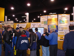
And here are some snapshots from the Northwest Aviation Conference in late February. Our booth was very busy — you're far from alone in using Voyager! Anyone recognize the guy in the dark suit? Please send us interesting pictures of you and/or your plane for the next issue. We began the year with a bang when the good folks at Aero-News gave us the Product of the Year award for Voyager 3.0. To quote a few passages: “At [Aero-News], this is the most used piece of aero-software we own”; “SmartPlates is a mind blower”; and “The entire program does it all... seamlessly, cost-effectively and backed up by a company that is getting rave reviews for customer support”. You can read the entire article at http://www.seattleavionics.com/ARTICLES_060102.shtml. We’re still blushing. The good news continued as the extremely innovative people at Eclipse Aviation chose Voyager as the flight planning partner for their unique JetComplete program. See http://www.seattleavionics.com/p_060224.shtml for the full story. Of course that’s good for us, but it’s also good for you, as we’ll be making changes to Voyager to make it more applicable to those flying high-performance piston, turboprop and jet aircraft (without changing anything about the way it works for the rest of us!). And those of you who operate charter airlines or corporate flight departments should also know that, as part of the agreement, we’re working on a “briefer” version of Voyager that makes pilot/briefer collaborative flight planning easy. Stay tuned for this one. Just in! Voyager/GlassView stars in a Microsoft video on their "Channel 10" Web site of cool technology. Voyager is used both pre-flight and in the cockpit during an actual flight. http://www.on10.net/TheShow/2484 In the latest release (version 3.0.0.30316), we’ve substantially expanded the XM weather support. Previously, we downloaded METARs, TAFs, TFRs and NexRad. Now we also show Cloud Tops, Echo Tops and Lightning Strikes. If you don’t already fly with the security of in-cockpit weather, you simply have to try it and you’ll never go back. Missions that used to be questionable or impossible now can be safely flown. Also in this last release, we added the most requested features ever: geo-referenced approach plates and airport diagrams. “Geo-referenced” is geek-speak for a plate with the data necessary to overlay your aircraft’s location. Oh, and unlike some Brand X offerings, you don’t have to point and click to calibrate each plate - that must be fun in-flight! - as we do all the work for you. Geo-plates requires both SmartPlates and GlassView. It also requires a new level of Annual NavData Subscription. Which brings us to the next topic… As many of you know, for years Seattle Avionics has offered an annual NavData subscription for $99. It includes automatic 28-day downloads of the latest NavData, as well as all the new versions of Voyager we make during the year, and premium weather (radar, satellite, etc.). Starting next data cycle (May 10), we’ll make an enhanced version of this offering and also two higher levels: VFR NavData Subscription ($99/yr): Ideal for the VFR pilot, this is the same as the current NavData Subscription, at the same price, but now with two additional benefits — scanned, geo-referenced VFR Sectionals and Terminal Approach Charts. Kiss those clunky printed Charts goodbye! As before, this still includes new digital NavData every 28 days and premium weather. IFR NavData Subscription ($148/yr): This new level includes everything in the VFR NavData Subscription and adds scanned, geo-referenced IFR Low-Level and Hi-Level Charts that are a convenient and legal replacement for those old-fashion printed Charts. EFB NavData Subscription ($247/yr): This top-level subscription gives pilots flying with Tablet PCs or laptops all they need to keep their EFB (Electronic Flight Bag) filled with everything current. In addition to what’s in the IFR NavData Subscription, this level includes geo-referenced approach plates and airport diagrams for thousands of airports. Imagine flying while seeing your plane’s position overlaid on both a scanned Low-Level Chart and an approach plate! Note: As before, scanned (and legal) IFR Approach Plates are a free benefit to using Voyager’s SmartPlates module. There is no annual or monthly fee for the scanned (but not geo-referenced) plates. Special Offer to Existing Customers If you’ve been with us for some time, you probably know that, unlike the cell-phone companies, we do everything we can to keep existing customers happy by giving you great deals as we introduce new products. And this is no exception. So, for existing customers, we’re offering the EFB subscription level (normally $247) for just $198. Better still, since many of you have existing NavData subscriptions, we’ll add the new benefits to the time left on your existing plan then add the additional 12 months. For example, if you’re 6 months into a NavData plan and buy the EFB level, you’ll get the EFB level for a total of 18 months for just $198! Use Coupon Code GEO when ordering (or just click here). One caveat: while the current version of Voyager (3.0.0.30316) supports geo-referenced plates, we’re still working on the scanned Charts and expect it within 30 - 60 days. In this section, we’ll mention a few of our favorite tips and tricks. In the future, we’d like to answer your questions directly. Please send your questions (and favorite tips!) to sales@SeattleAvionics.com
On April 20, we heard the sad news that Scott Crossfield, aviation legend, died in a crash of his Cessna 210. He will be missed by all of us, but, speaking just for myself, dying at 84 doing what you’ve loved your whole life doesn’t sound like a bad way to go. As you probably already knew, Crossfield flew legendary experimental planes while working for NACA, NASA’s predecessor. But did you also know that an even more famous test pilot flew at NACA at about the same time — Neil Armstrong. After Crossfield checked out the X-15 while working for the builder, North American, Armstrong and other pilots took it up well over the 100,000 ft. / Mach 3 limits that Crossfield was contractually obligated to observe. And like Crossfield, Armstrong enjoyed the engineering aspect of being a test pilot nearly as much as the actual piloting. If you haven’t read it yet, we strongly recommend James Hansen’s First Man: The Life of Neil Armstrong. Until next time, happy flying!
- The sales
|