The following screenshots briefly illustrate the different screens that
SmartPlates offers and how simple keeping your plates current can be when you use technology the right way.
Plate Pack
Window |
Plate Pack Wizard | Information |
Printing |
Customizing the Chart
|

This is the main
window in SmartPlates. It's divided into four sections:
Filter, Available,
Selected and Chart/Procedure.
These reflect the usual information flow through the product. That is, you
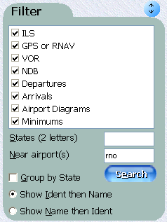
use the Filter area to select the types of procedures you like and
airports that interest you. That produces the Available list.
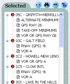
The Plate Pack is defined by the items in the Selected area so moving a
procedure (or whole airport) from Available to Selected adds it to
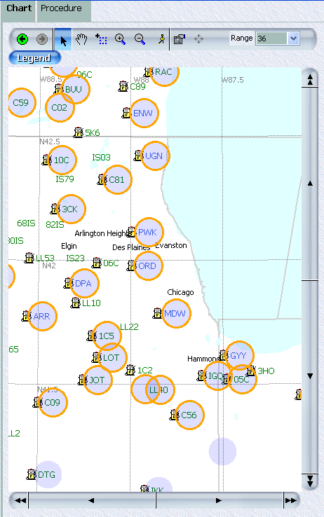
the Plate Pack. The Chart/Procedure area show either a Chart of all
selected airports or a specific Procedure or Diagram.
|
| |
 |
Use the Filter area to select just the airports and procedure types
you want. For example, check just ILS and GPS or RNAV to
skip VOR or NDB-based procedures. Or enter WA CA OR to select
all the airports in Washington state, California and Oregon. You can
even find all the airports within a 50 NM radius of any other airport by
typing its name or ident into the Near airport(s) field. Click
Search and SmartPlates populates the Available list
(below) with the selected airports. |
|
|
|
 |
The Selected list shows the airports that are actually in the Plate
Pack. Different icons show whether, for the purpose of
print organization, an airport
should be considered a takeoff airport (BFI), a landing airport (AWO),
a Fuel Stop (BVS), an Alternate (not shown) or Other.
Use the  and
and  to remove one or all the procedures.
 |
|
Finally, zoom-in the Chart to see
a visual representation of the selected airports. All US airports are
shown. The ones with green circles have at least one procedure or airport
diagram available. The ones also circled in red are the ones in the
Selected list. Of course, you can use your mouse to add and remove
airports using the chart. Even use the
 (select
airports) tool to select all the airports in an area. (select
airports) tool to select all the airports in an area. |

Plate Pack
Window |
Plate Pack Wizard |
Information |
Printing |
Customizing the Chart
|